When most people think about satellites, they imagine a machine floating high above Earth and somehow sending TV signals, weather images, internet data, or map information back to us. What usually stays hidden is the most important engineering decision behind every satellite mission: its orbit. A satellite’s orbit is not a decorative technical detail. It is the mission architecture itself. It decides how often the spacecraft can see a place on Earth, whether it can watch the same storm continuously or only revisit it later, whether it can capture land images under nearly identical sunlight every day, whether it can serve people in high-latitude regions where geostationary satellites sit low on the horizon, how much fuel it must spend to stay in position, how much launch energy is required to place it there, and even how long it may survive before atmospheric drag or orbital decay become a problem.
The topic becomes even more interesting once you look at it through real examples. A weather satellite that must keep watching the same cyclone hour after hour needs a very different orbit from a remote sensing satellite that compares crop patterns under consistent sunlight. A communication satellite serving television and telecom links over a fixed region needs a very different orbit from a spacecraft designed to study forests, coastlines, snow cover, or sea surface conditions. India’s own space history reflects this logic beautifully. Early experimental Earth observation satellites such as Bhaskara-I and Bhaskara-II flew in low Earth orbit. The Rohini series helped India master indigenous launch capability through low-orbit experimentation. The IRS programme matured in sun-synchronous orbit because remote sensing needs repeatable lighting and predictable ground coverage. APPLE and later communication satellites demonstrated why geosynchronous and geostationary positions matter for telecom and broadcasting. The orbit always follows the purpose.
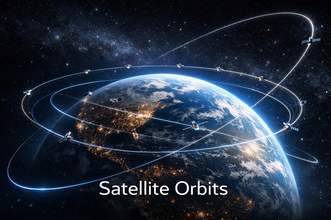
This article turns the short classroom-style notes on “types of satellite orbits” into a full, deeply researched explanation. It covers the four major orbit ideas most students meet first—Low Earth Orbit (LEO), Sun-Synchronous Orbit (SSO), Geostationary/Geosynchronous Orbit, and Molniya Orbit—and then connects them to real missions, especially Indian examples. Along the way, it explains why the same Earth can look completely different to a satellite depending on altitude, inclination, eccentricity, period, and local solar time. If you want one resource that explains not just what these orbit names mean, but why they matter in practice, this is designed to be that resource.
Before the orbit types: what an orbit actually is
An orbit is the curved path an object follows around another object because gravity keeps pulling it inward while its forward velocity keeps carrying it ahead. That balance between gravity and motion creates a continuous fall around Earth rather than a fall straight down to the surface. Every satellite orbit can be described using a few core ideas. Altitude tells you how high the spacecraft is above Earth. Inclination tells you how tilted the orbit is relative to Earth’s equator. Eccentricity tells you how circular or stretched the orbit is. Orbital period tells you how long one full revolution takes. Together these determine what the satellite can see, how often it returns over the same region, how much of Earth it can cover, and whether it appears to move across the sky or remain almost fixed from the ground.
For people new to the subject, the most useful mental model is this: the lower the orbit, the closer the satellite is to Earth, the faster it must move, and the smaller the portion of Earth it sees at any one moment. The higher the orbit, the larger the visible area becomes, but the longer the communication path grows and the more launch energy is needed. A highly circular orbit gives steady distance from Earth; a highly elliptical orbit lets a satellite linger far away over one region and swing rapidly through another part of its path. A polar or near-polar orbit helps cover most of the planet because Earth rotates beneath the spacecraft. An equatorial orbit can keep staring at one broad region. Orbit design, in other words, is mission design translated into geometry.
Low Earth Orbit (LEO): the busiest neighborhood in space
Low Earth Orbit, usually called LEO, is the region closest to Earth where most operational satellites, scientific spacecraft, crewed stations, and many Earth observation missions work. A commonly used modern definition places LEO at roughly 160 to 2,000 kilometers above Earth, though some older textbook summaries use narrower ranges depending on the mission type being discussed. This is an important distinction, because student notes often simplify LEO by citing the altitude band typical for certain remote sensing satellites, while the broader aerospace definition includes a much wider vertical range.
LEO is attractive because it offers proximity. A spacecraft in LEO is close enough to Earth for detailed imaging, faster communication links, easier launch access compared with much higher orbits, and lower signal delay. That closeness is one reason so many Earth observation missions live there. Cameras, radar systems, atmospheric sensors, and scientific instruments benefit from being relatively near the surface they are observing. The lower altitude means smaller targets on the ground can be seen with greater potential detail than would be practical from geostationary distance. For the same reason, human spaceflight also favors LEO. The International Space Station operates there because a crewed laboratory needs manageable transport, regular resupply, and a reachable environment for long-duration operations.
But LEO’s advantages come with trade-offs. Because satellites are close to Earth, they move very quickly to stay in orbit. From the ground they do not appear fixed. They sweep across the sky and overfly a region for only a short period during each pass. That means a single LEO satellite cannot continuously watch one place. If you want uninterrupted service, you need either a constellation of many satellites or a mission that accepts periodic revisits rather than constant visibility. Another issue is atmospheric drag. Even though the air is extremely thin at those altitudes, it is not absent. Over time, drag slows satellites down and lowers their orbits, especially in the lower part of LEO, which is why many spacecraft require reboosts, orbit maintenance, or controlled disposal planning.
LEO is also the most crowded orbital environment. That is not an abstract concern. It matters for collision risk, debris management, and future sustainability. The concentration of active satellites, defunct spacecraft, rocket bodies, and fragments is particularly significant in some low-orbit altitude bands. The region remains incredibly valuable, but it is no longer empty space in any practical engineering sense. A modern discussion of LEO has to include not just opportunity, but stewardship.
To understand why LEO remains so dominant, it helps to look at its major use cases one by one. The first is Earth observation. Whether the mission is mapping coastlines, tracking forest loss, measuring soil moisture, watching glaciers, estimating crop health, or identifying damage after floods and cyclones, LEO is often the preferred orbital zone because it balances image detail, coverage, and mission cost. The second is weather and environmental monitoring through polar-orbiting systems that gather global data. The third is human spaceflight and microgravity research, because crewed platforms like the International Space Station need repeated access and manageable logistics. The fourth is modern communications constellations, where large numbers of satellites in LEO can reduce latency compared with geostationary systems, though such constellations require far more spacecraft to maintain broad coverage.
A notable and globally famous LEO example is the International Space Station. NASA describes the ISS as orbiting about 250 miles above Earth, moving at roughly 17,500 miles per hour. It circles Earth again and again as a laboratory, classroom, and proving ground for future exploration. Its orbit is not just a technical choice; it is the reason astronauts can be sent there, resupplied, and returned with relative feasibility compared with higher or deeper-space destinations. That same low orbit gives the ISS a spectacular view of Earth and makes it a productive platform for research in medicine, materials science, biology, Earth observation, and operational testing.
A major Indian example tied to the educational notes on this topic is Bhaskara-II. ISRO identifies Bhaskara-II as an experimental Earth observation satellite in LEO, launched on 20 November 1981, carrying TV cameras and a three-band microwave radiometer called SAMIR. Its orbit was approximately 541 × 557 km, and its payloads were used for Earth observation experimentation. This was not simply a satellite floating in space for prestige. It was part of a learning curve that helped India build remote sensing capability in agriculture, water resources, meteorology, and ocean-related observation. The satellite’s low orbit made that data collection possible because Earth observation missions require closeness far more than fixed-point visibility.
Bhaskara-I, launched earlier in 1979, belongs in the same story. ISRO describes it as the first experimental remote sensing satellite built in India. Its TV camera imagery was used in hydrology and forestry, while data from the SAMIR instrument supported oceanographic studies. Even when educational notes summarize Bhaskara-I in a few words, the mission deserves more attention because it represents an early demonstration of how low-orbit Earth observation could serve practical national needs. Hydrology, forestry, oceanography, and later meteorology are not just academic disciplines here; they are the reasons the orbit mattered. A satellite meant to support resource observation has no need to sit motionless over one point 35,786 km away. It needs repeated close passes and useful instruments.
Another Indian LEO landmark is the Rohini satellite series, especially RS-1. ISRO states that Rohini RS-1 was successfully launched on 18 July 1980 aboard SLV-3 into an orbit of about 305 × 919 km with an inclination of 44.7°. The spacecraft carried sensors such as a digital sun sensor, magnetometer, and temperature sensors. Rohini’s significance is larger than its mass. It marked India’s success in placing a satellite into orbit using an indigenous launch vehicle, a foundational achievement in national space capability. In orbital terms, Rohini also reminds us that not every LEO mission is primarily about imaging or telecom. Some missions exist to validate launch systems, spacecraft subsystems, telemetry, and operational know-how.
LEO’s strengths can be summarized in one line: it is where proximity pays. If your mission benefits from being near Earth—high-detail observation, lower latency, scientific access, or crew transportation—LEO is likely to be part of the conversation. Its weaknesses are equally clear: limited continuous regional visibility, atmospheric drag, and growing congestion. That is why engineers do not stop at choosing “LEO.” They go further and ask what kind of LEO is needed. One of the most important answers to that question is the sun-synchronous orbit.
Sun-Synchronous Orbit (SSO): the orbit built for fair visual comparison
A Sun-Synchronous Orbit, or SSO, is not a completely separate altitude class like LEO or GEO. Instead, it is a special kind of near-polar orbit, usually in low Earth orbit, designed so that the satellite passes over the same part of Earth at nearly the same local solar time on each visit. That simple sentence contains the whole logic of the orbit. If the sunlight angle is kept nearly consistent from pass to pass, images taken days, weeks, or years apart can be compared much more fairly. Shadows do not change wildly from one image to the next merely because the spacecraft arrived at a different time of day. For scientists, surveyors, planners, and disaster managers, that consistency is extremely valuable.
This is why SSO is often the preferred orbit for remote sensing, land imaging, environmental monitoring, cartography, and many weather and climate missions. If you are trying to detect whether a forest has been cut, whether a glacier has retreated, whether crops are under stress, whether wetlands are shrinking, or whether urban growth is spreading, you want to minimize false visual differences caused by changing illumination. NASA’s Earth science material explains this clearly: the sun-synchronous orbit keeps the angle of sunlight on Earth’s surface as consistent as possible, which is why it is so useful for long-term scientific comparison.
Technically, SSO works because the orbit is designed to precess at nearly the same rate that Earth moves around the Sun. The orbital plane slowly rotates over time in a controlled way, allowing the spacecraft to maintain a nearly constant relationship with the Sun. In plain language, the satellite and the Sun stay in sync from the perspective of local time. If a mission is designed to cross the equator in the morning, it keeps doing so at nearly that same solar time every cycle. That is a subtle engineering trick, but it has major practical consequences for data quality.
Most sun-synchronous satellites are also polar or near-polar. That means they travel generally north-south while Earth rotates beneath them. Over repeated orbits, they build up wide geographic coverage. The combination is powerful: broad or global coverage plus consistent lighting. That is why SSO is so dominant in Earth observation history. It offers a strong compromise between repeated access and imaging reliability.
One of the best-known examples globally is the Landsat programme. The U.S. Geological Survey states that Landsat 8 operates in a sun-synchronous, near-polar orbit at about 705 km altitude, with an inclination of 98.2°, an orbital period of roughly 99 minutes, and a 16-day repeat cycle. That is a textbook example of SSO being used exactly as intended. Landsat’s job is long-term land imaging, which means visual consistency over time is essential. Without a sun-synchronous design, comparing land cover across seasons and years would be far more difficult because lighting changes would confuse interpretation.
India’s most important example in this category is IRS-1A, the first satellite in the Indian Remote Sensing series. ISRO states that IRS-1A was launched on 17 March 1988 into a polar sun-synchronous orbit. It carried the LISS-I and LISS-II cameras, with resolutions of 73 metres and 36.25 metres respectively, and a swath width of about 140 km during each pass over the country. This was a major step in India’s operational remote sensing capability. It is one thing to know in theory that SSO is useful for Earth observation. It is another to see how a national space programme adopted that orbit for a sustained practical purpose: agriculture, water resources, land use mapping, forestry, and planning.
The educational note that says “IRS is placed in this orbit” is absolutely correct in spirit, but the full story is richer. ISRO’s Earth observation history shows that India went on to build a large and diverse remote sensing fleet in SSPO, or Sun Synchronous Polar Orbit. Missions such as Cartosat, Resourcesat, Oceansat, RISAT, SCATSAT, SARAL, and others demonstrate how strongly Earth observation as a domain depends on sun-synchronous design. The reason is not tradition; it is utility. Mapping, terrain modelling, coastline monitoring, crop assessment, and climate-linked observations all benefit from repeated, comparable lighting geometry.
SSO also shows why orbit selection is not just about altitude. Many sun-synchronous missions fly between roughly 500 and 900 km, which overlaps with common LEO altitudes. The real differentiator is not simply height, but the relationship between height, inclination, and the slow rotation of the orbital plane. Educational charts often list SSO altitude bands such as 500–1000 km because many missions do fly there, but the defining feature is the local-time synchronization, not the altitude alone.
One subtle but important point is that SSO is not effortless to maintain. NASA notes that atmospheric drag and gravitational effects from Earth, the Sun, and the Moon perturb the orbit, which means regular adjustments are needed to keep the mission properly sun-synchronous. Students sometimes imagine an orbit as a perfect invisible rail in space. Real orbits are not like that. Spacecraft need orbit determination, maneuver planning, and station-keeping logic if their data quality depends on precise repeat conditions. For a remote sensing mission, drifting away from the intended local solar time is not a trivial issue. It changes shadow geometry and can weaken long-term comparison quality.
Another excellent example is Terra, one of NASA’s major Earth science missions, and other environmental satellites that live in sun-synchronous orbit because they are designed to build long records of changes in land, ocean, atmosphere, and ice. In other words, SSO is the orbit of disciplined observation. It is not meant to stare continuously at the same point like a geostationary weather satellite. It is meant to build trustworthy comparative records over time.
So what makes SSO so important in practical terms? It gives scientists and governments a reliable way to answer questions such as: Has this glacier shrunk? Has this river floodplain changed? How has this city expanded? Are crop conditions better or worse than last season? Has wildfire damage altered land cover? Has drought changed vegetation reflectance? These are not one-time questions. They are comparison questions. And comparison questions need consistent observational geometry. That is exactly what sun-synchronous design was built to support.
Geosynchronous and geostationary orbit: when the sky seems to stop moving
The next concept is often taught in a simplified way, and it is worth making one clarification at the beginning. A geosynchronous orbit is any Earth orbit with a period equal to Earth’s rotation, about 23 hours 56 minutes 4 seconds, which is a sidereal day. A geostationary orbit is a special case of geosynchronous orbit: it must be circular, lie above the equator, and move in the same direction as Earth’s rotation. Only then does the satellite appear stationary above one fixed longitude. In many school-level notes, “geosynchronous” and “geostationary” are used loosely, but technically geostationary is the exact word for the stationary case people usually imagine.
That stationary case occurs at an altitude of about 35,786 km above Earth’s equator. ESA explains that a geostationary satellite moves west to east, exactly matching Earth’s rotation, completing one orbit in one sidereal day. Because of that exact match, the spacecraft appears fixed over one location to ground observers. NASA Earthdata similarly identifies 35,786 km as the altitude where orbital speed matches Earth’s rotation. This is one of the most important numbers in space operations because it defines the classical high-altitude ring used for communications and full-disk weather observation.
The biggest strength of geostationary orbit is not image detail. It is continuity. A GEO satellite keeps looking at the same region all the time. That makes it ideal for telecommunications, television broadcasting, satellite newsgathering, weather monitoring, disaster warning, and some forms of search and rescue support. If a broadcaster wants a fixed link, if forecasters want uninterrupted views of cloud motion over an ocean basin, or if a warning system needs constant watch over a cyclone’s development, geostationary orbit becomes extremely attractive.
A leading example is the GOES system operated by NOAA with NASA support. NOAA explains that the GOES-R series provides advanced imagery and atmospheric measurements, real-time lightning mapping, and space weather monitoring. NASA’s GOES mission pages similarly emphasize that these satellites provide continuous imagery and atmospheric data, helping forecasts, storm warnings, fire detection, and environmental monitoring. Their power comes from staying fixed over broad regions rather than sweeping past them quickly. A geostationary weather satellite does not need to revisit a storm later; it keeps watching as the storm evolves.
That continuity is precisely why GEO remains central to modern meteorology. NOAA notes that GOES imagery can be updated very rapidly, with severe weather products available as often as every 30 seconds in some operating modes. This is the opposite of the typical LEO or SSO trade-off. A geostationary imager sees a huge portion of Earth constantly, but with less close-up detail than a lower-altitude platform. A sun-synchronous imager can see smaller features in greater detail, but only during overpasses. In operational forecasting, the two are complementary rather than interchangeable.
India’s space programme provides an equally strong geostationary and geosynchronous story. ISRO states that the INSAT system, with more than 200 transponders across multiple frequency bands, provides services for telecommunications, television broadcasting, satellite newsgathering, societal applications, weather forecasting, disaster warning, and search and rescue. That single sentence captures why high-altitude communication architecture matters. India is large, geographically varied, and in constant need of communication and meteorological connectivity. A fleet of high-positioned satellites can support those requirements efficiently.
A particularly instructive Indian example is APPLE, the Ariane Passenger Payload Experiment. ISRO describes APPLE as its first indigenous experimental communication satellite. It was launched into Geosynchronous Transfer Orbit in 1981 and then boosted into geosynchronous orbit using an apogee motor. APPLE gave ISRO practical experience in designing and developing three-axis stabilized geostationary communication satellites, orbit raising, deployment, and station-keeping. This mission matters historically because it shows that a geostationary system is not just about the final orbital slot. It also requires mastery of the journey there: transfer orbit injection, apogee firing, control, and orbital management.
Another major Indian example is INSAT-3D. ISRO describes it as an advanced weather satellite configured with an imaging system and atmospheric sounder for enhanced meteorological observation, monitoring of land and ocean surfaces, vertical profiling of atmospheric temperature and humidity, weather forecasting, and disaster warning. INSAT-3DR and INSAT-3DS continue that geostationary meteorological role. These satellites show why GEO is still vital even in the era of huge low-orbit constellations: some jobs fundamentally require continuous watch. When the task is nowcasting storms, tracking cloud systems, or monitoring rapidly changing weather, geostationary orbit remains indispensable.
It is also worth noting that geosynchronous orbit is not limited to the “perfectly stationary” equatorial case. India’s NavIC/IRNSS system uses a mix that includes satellites in geostationary and geosynchronous configurations. ISRO states, for example, that IRNSS-1A in GSO has been used for safety-of-life alert dissemination, including alerts on cyclones, tsunamis, and high sea waves to the fishing community in areas with poor terrestrial communication support. That is an excellent reminder that once you move beyond school diagrams, orbit categories become mission tools with nuanced variations.
Still, geostationary orbit is not perfect. One limitation is geometry. Because GEO satellites sit above the equator, they view high-latitude regions at lower angles. That makes them less effective for very far northern or southern areas, especially compared with systems designed specifically for those latitudes. Another limitation is altitude itself. Signals travel a very long distance, which introduces higher latency than LEO systems. For some applications this is acceptable; for others it is not. A third issue is resolution. For imaging, distance matters. A geostationary weather image is operationally priceless, but it is not the same thing as a close-range Earth observation image from a lower orbit.
Yet for broadcasting, telecommunications, fixed regional monitoring, and meteorology, GEO remains one of the most powerful orbits humanity has ever used. If LEO is the orbit of proximity, GEO is the orbit of permanence over a region.
Molniya orbit: the elegant solution to the high-latitude problem
The Molniya orbit is one of the most fascinating orbit designs in practical space history because it was created to solve a problem geostationary satellites cannot solve well: strong coverage of very high latitudes. A geostationary satellite sits over the equator. That is perfect for broad coverage of mid-latitude and equatorial regions, but not ideal for far northern areas, where the satellite appears low toward the horizon and coverage geometry becomes weak. For countries with large populations, infrastructure, or military interests at high latitudes, that is a serious limitation. The Molniya orbit was invented to answer it.
NASA’s Earth Observatory describes Molniya as a highly elliptical orbit that works well for observing high latitudes. It combines a high inclination of about 63.4° with high eccentricity and a roughly 12-hour orbital period. Because the orbit is extremely stretched, the satellite moves very fast near perigee—the low part of the orbit—but slows dramatically near apogee, the high part. As a result, it spends a disproportionate amount of time near one hemisphere. NASA notes that a satellite in Molniya orbit spends about two-thirds of its time over one hemisphere. That lingering behavior is the whole point.
Think of Molniya as the opposite of a neat circular path. Instead of trying to stay fixed over the equator, it repeatedly rushes through the lower part of its orbit and then hangs high for long periods over the latitude zone of interest. Because of that, a small number of carefully phased satellites can provide long-duration coverage over regions such as Russia, northern Europe, Greenland, or Canada. In practical communication terms, Molniya can play a role similar to geostationary orbit for northern territories, but with a different geometry better suited to those latitudes.
The orbit’s name comes from the Soviet Molniya satellite series. Britannica notes that the first Molniya 1 satellite was launched on 23 April 1965, and by 1967 six Molniya satellites were providing coverage across the Soviet Union. This historical detail matters because it shows the orbit was not just a theoretical curiosity. It became an operational answer to a real geographic problem. The former Soviet Union had immense northern territory that could not be served elegantly by standard equatorial geostationary positioning. Molniya was, in effect, a political geography orbit as much as an engineering one.
NASA’s Earth Observatory also notes that Russian communication satellites and even Sirius radio satellites have used this type of orbit. That is a notable example of the orbit’s continued relevance. When people first hear about Molniya, they sometimes assume it belongs only to Cold War textbooks. In reality, the logic behind it remains valid whenever the mission requires strong dwell time over high latitudes without the disadvantages of very low-elevation geostationary links.
Molniya orbit is often described in school notes as a “long elliptical orbit,” and that is a helpful first approximation. The more precise description is a highly elliptical, high-inclination orbit with special geometry that helps stabilize the argument of perigee at the critical inclination near 63.4°. That precise design allows the apogee to remain usefully positioned for repeated high-latitude coverage. In simpler terms, the orbit is engineered to keep spending a lot of time in the part of space where the mission gets the most value.
What does Molniya do well? It does well where geostationary coverage weakens. It offers high viewing angles over northern regions. It can support communications, surveillance, meteorology, and strategic warning systems in places where equatorial orbit is awkward. It can provide long dwell times without the need to send a satellite all the way into geostationary altitude for the entire orbit. It is a specialized answer for a specialized requirement.
What does it not do well? It is not ideal for constant worldwide communication the way a large LEO constellation or broad geostationary network might be. Its path is more complex. Ground systems must handle the geometry of satellites that are not fixed in one place in the sky in the geostationary sense. It is a targeted solution, not a universal one. And for countries not dominated by high-latitude coverage needs, it may not be the most efficient choice.
For Indian exam preparation and conceptual clarity, the key point is this: Molniya orbit exists because the Earth is not equally easy to observe or serve from every latitude. Orbit design responds to geography. If GEO is great for fixed equatorial-based coverage and SSO is great for repeatable Earth imaging, Molniya is the clever answer for long dwell over far northern regions.
The Indian satellite examples in their proper orbital context
The educational page that mentions Bhaskara-I, Bhaskara-II, Rohini, and IRS is doing something very important, even if briefly: it connects orbit type to the history of Indian space capability. To really understand the topic, these examples should not be memorized as isolated factoids. They should be read as a progression in mission logic.
Bhaskara-I was India’s first experimental remote sensing satellite. ISRO says its onboard TV camera imagery was used for hydrology and forestry, and SAMIR data supported oceanographic studies. That mission belongs naturally in low Earth orbit because remote sensing of land and water depends on relatively close observation. A high geostationary perch would not have matched the mission’s data needs. The orbit was not incidental; it was part of the mission’s scientific usefulness.
Bhaskara-II continued that Earth observation experimentation in LEO. ISRO lists it as an Earth observation satellite with an orbit of roughly 541 × 557 km. The note in the screenshot that mentions sea surface temperature, snow cover, and weather conditions reflects the broader practical use of such remote sensing instrumentation. In a larger historical sense, Bhaskara-I and II were bridge missions. They taught India how to design, build, and use remote sensing spacecraft before the fully operational IRS era matured.
Rohini belongs to a different but equally important category. The series is early in Indian satellite history because it is tied to indigenous launch capability. ISRO notes that Rohini RS-1 rode SLV-3 into orbit in July 1980, and the broader significance of that success is hard to overstate. The satellite’s own payloads were valuable, but the larger national lesson was that India could place a satellite into orbit using its own launch vehicle. Rohini therefore represents a low-orbit technological proving ground. It shows that orbit choice sometimes follows engineering development needs as much as application goals.
IRS-1A marks a more mature turn. Once India needed operational remote sensing rather than only experimental demonstration, a polar sun-synchronous orbit became the right answer. The IRS programme was built for systematic imaging and repeat observation, not just a one-off technical achievement. The choice of SSO aligned India’s space applications with the needs of agriculture, forestry, land-use mapping, water resource planning, and environmental monitoring. In other words, India moved from experimental low-orbit sensing to disciplined sun-synchronous observation because the mission requirements evolved.
If we extend the Indian story one step beyond the screenshot, APPLE becomes the perfect high-orbit counterpart. Once the goal shifted toward communication, geosynchronous operation mattered. Then the broader INSAT and GSAT systems expanded that capability for telecom, broadcasting, weather, and public service functions. Seen as a sequence, India’s satellite history is a masterclass in why no single orbit can serve every purpose.
A direct comparison of the four orbit types
| Orbit Type | Typical Altitude/Geometry | Main Strength | Main Limitation | Typical Uses | Notable Examples |
|---|---|---|---|---|---|
| Low Earth Orbit (LEO) | Roughly 160–2,000 km above Earth | Close to Earth, lower latency, higher observation detail | No continuous view of one location; drag and congestion matter | Earth observation, science, human spaceflight, some communications | ISS, Bhaskara-II, Rohini RS-1 |
| Sun-Synchronous Orbit (SSO) | Near-polar LEO designed to keep constant local solar time | Consistent lighting for repeat imaging and long-term comparison | Not continuous over one region; needs precise maintenance | Remote sensing, mapping, environmental monitoring, climate studies | Landsat 8, IRS-1A, Cartosat series |
| Geostationary / Geosynchronous Orbit | 35,786 km; geostationary is the equatorial circular special case | Continuous watch over the same region | Greater distance, higher latency, weaker high-latitude geometry | Telecom, broadcasting, weather monitoring, disaster warning | GOES, INSAT-3D, INSAT-3DR, APPLE |
| Molniya Orbit | Highly elliptical, high-inclination, ~12-hour period | Long dwell over high latitudes | Specialized geometry; not a universal replacement for GEO | High-latitude communications and monitoring | Molniya satellites, Sirius radio satellites |
How engineers choose the “right” orbit
If all these orbit types are useful, how do mission planners decide between them? They start with the mission question. If the goal is to watch the same storm continuously, geostationary orbit becomes a natural candidate. If the goal is to build a clean multi-year imaging archive of land and vegetation change, SSO rises to the top. If the goal is to run a crewed science platform or fly instruments close enough for detailed Earth observation, LEO becomes attractive. If the goal is strong service to very high latitudes, Molniya may be superior to geostationary geometry.
Next comes the question of spatial resolution versus coverage. Close orbits can see smaller features but only over narrower swaths at a given moment. Distant orbits can see a huge region all at once but with less fine-grained detail. Then comes temporal coverage: do you need continuous stare, frequent revisit, or just regular periodic coverage? Then comes latency: high-altitude communication links take longer than low-orbit links because the signal path is longer. Then comes launch cost and energy: higher and more specialized orbits can demand more propulsion and more mission complexity. Then comes lifetime and station-keeping: low orbits suffer drag, sun-synchronous missions need maintenance, geostationary missions need fuel for station-keeping and end-of-life disposal planning.
There is also the question of the instrument itself. A microwave sounder, optical imager, radar payload, telecom transponder, navigation payload, or atmospheric sounder may each have a different orbital preference. A broadcaster cares about fixed coverage. A crop scientist cares about repeatable lighting. A navigation system may use a constellation design that optimizes signal geometry over a region. An astronaut programme cares about access and resupply. The instrument and the mission always talk to the orbit.
Orbit types and daily life on Earth
One of the easiest ways to understand why orbital theory matters is to link it to daily life. Weather forecasts depend heavily on both geostationary and polar/low-orbit satellites. Geostationary satellites like GOES and India’s INSAT weather satellites provide continuous imagery of cloud systems, storms, and lightning. Polar and low-orbit weather systems provide global measurements that improve forecasts days in advance. Agriculture depends on remote sensing satellites in sun-synchronous orbit that observe vegetation, moisture, and land use under consistent lighting conditions. Television broadcasting and telecom links have long relied on geostationary systems because dishes can remain pointed at fixed orbital slots. Disaster warning benefits from both constant-watch weather satellites and detailed post-event low-orbit imaging. Search and rescue, fishermen alerts, and other public services may rely on high-orbit communication or navigation-related satellites as part of a broader national system.
Even something as ordinary as a map update or the detection of a flood extent after heavy rain can reflect the work of multiple orbit types. A geostationary meteorological satellite may first monitor the storm system continuously. A polar or sun-synchronous satellite may later provide detailed imagery for damage assessment or land-surface analysis. A communication satellite may help distribute warning products. Orbital diversity is not redundancy for its own sake. It is how the full system becomes useful.
The hidden difficulties: drag, debris, disposal, and maintenance
No discussion of satellite orbits is complete without the maintenance problem. A common beginner misconception is that once a satellite is injected into orbit, the job is done. In reality, each orbital region imposes its own long-term burdens. In LEO, atmospheric drag slowly erodes orbits, especially at lower altitudes. ESA notes that satellites launched into LEO are continuously exposed to aerodynamic forces from the upper atmosphere, and depending on altitude, the resulting resistance can cause reentry over timescales from weeks to centuries. This is why station-keeping, reboosts, and end-of-life planning matter so much.
LEO is also the most debris-sensitive region. ESA notes that debris concentrations peak strongly in some low-orbit bands, especially around 800–1000 km. The first accidental collision between two satellites in orbit, Iridium 33 and Kosmos 2251, occurred at 776 km altitude and produced thousands of trackable fragments. This is one reason orbital sustainability has become a major policy and engineering issue. The usefulness of LEO is enormous, but that usefulness can be degraded if the environment is not managed responsibly.
In SSO, the challenge is not only drag but also maintaining the proper local-time geometry. NASA notes that perturbations from drag and gravitational influences require regular adjustments. That matters because the scientific value of SSO depends on staying synchronized with the Sun. A drifted sun-synchronous mission may still be in orbit, but its data record can become less clean for comparison purposes.
In GEO, the challenge is different. There is no significant atmospheric drag, but the spacecraft must still perform station-keeping to remain in its assigned slot and orientation. At end of life, disposal becomes essential. ISRO notes, for example, that GEO missions include post-mission disposal planning; INSAT-4B was re-orbited about 340 km above GEO altitude in compliance with international debris mitigation guidance. In other words, the high-altitude orbit may seem calm from a classroom perspective, but it too requires careful life-cycle management.
Molniya missions bring their own demands because highly elliptical, high-inclination geometry is inherently specialized. The reward is excellent high-latitude dwell time, but the operational system must be designed around those passes and the varying distance to Earth across the orbit. Once again, the orbit is not simply a path; it is an operational environment.
Why this topic matters so much in exams and in real-world understanding
Students often encounter satellite orbits first through short bullet points: LEO is close to Earth, SSO passes the same place at the same local time, geostationary satellites appear fixed, and Molniya is elliptical. Those bullet points are useful, but they become far more powerful when connected to mission purpose. Once you understand the “why,” the facts become much easier to remember. LEO is close because many missions need detail, access, or lower latency. SSO exists because consistent sunlight is essential for fair comparison. GEO is used because some services need continuous regional watch. Molniya exists because high latitudes are not well served by equatorial geostationary geometry.
This way of thinking also helps with tricky questions. If an exam asks which orbit is best for continuous weather monitoring over the same region, you can reason toward geostationary. If it asks which orbit is used for repeated land imaging under similar lighting, you can reason toward sun-synchronous. If it asks why a country with very high northern territory might use a highly elliptical orbit, you can reason toward Molniya. If it asks why early remote sensing missions often used low orbit, you can connect altitude with imaging detail and instrument practicality.
Final understanding: no orbit is “best” in the abstract
The biggest lesson from this topic is that no single orbit is best for everything. Low Earth Orbit is excellent for closeness, detail, and access, but weak for continuous fixed-region visibility. Sun-Synchronous Orbit is excellent for repeated observation under nearly consistent lighting, but it still cannot stare at one place continuously the way GEO can. Geostationary Orbit is unmatched for constant regional watch and fixed communications links, but its high altitude limits detail and makes polar viewing weaker. Molniya Orbit solves the high-latitude coverage problem beautifully, but only for missions that actually need that geometry.
Once you see orbit choice as a mission answer instead of a memorized label, the entire subject becomes coherent. Bhaskara missions used low orbit because India needed remote sensing experience. Rohini flew in low orbit because launch capability had to be proven and measured. IRS-1A entered sun-synchronous orbit because Earth observation depends on repeatability and consistent illumination. APPLE and INSAT expanded into geosynchronous and geostationary space because communication and weather services demanded persistent regional coverage. The orbit always follows the purpose. That is the single most important idea to carry away from this topic.